After a quiet start, late December featured a series of atmospheric rivers that delivered widespread precipitation across California. These late-month storms delivered meaningful precipitation to much of the state and added significant snowpack.
Spatial Comparison
California Water Watch (CWW) precipitation maps (with CAP regions overlaid) illustrate how dramatically conditions evolved during the final two weeks of December. The images below show water-year-to-date precipitation as a percent of average through December 17 (top) and December 31 (bottom), with statewide precipitation statistics shown alongside each map.
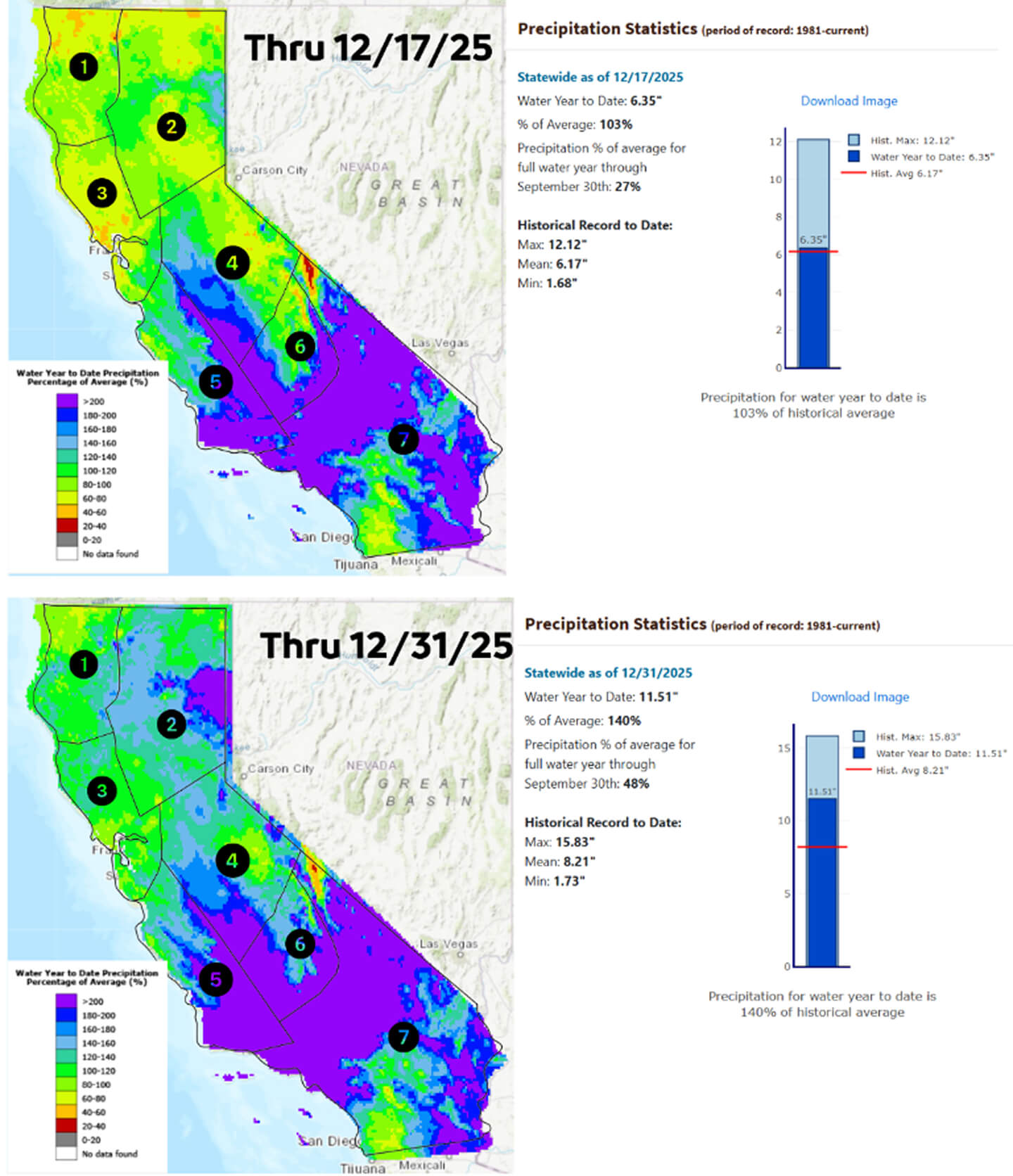
As of December 17, California was near-average overall, with statewide precipitation totaling 6.35 inches, or 103% of average to date. Spatially, much of Northern and Central California hovered near normal, with pockets at 60-80% of normal in CAP regions 1-4. Most of Southern California had well above-average precipitation. As of December 17, the state had reached 27% of its average full water-year precipitation, reflecting a steady but unremarkable early-season trajectory.
Conditions shifted rapidly over the final two weeks of the month. By December 31, statewide precipitation had climbed to 11.51 inches, pushing California to 140% of average for the water year to date and 48% of average for the full water year. Spatially, Regions 1–4 show a clear transition to wetter conditions, with much of Northern and Central California shifting from below- to near-normal categories (oranges and yellows) into above-normal ranges (greens and blues). Portions of Region 2 in the Northern Sierra now exceed 200% of normal, reflecting the concentrated late-December storms and associated snow accumulation at higher elevations. While the color scale masks some of the highest totals in Regions 5–7, the statewide signal clearly reflects broad and substantial accumulations.
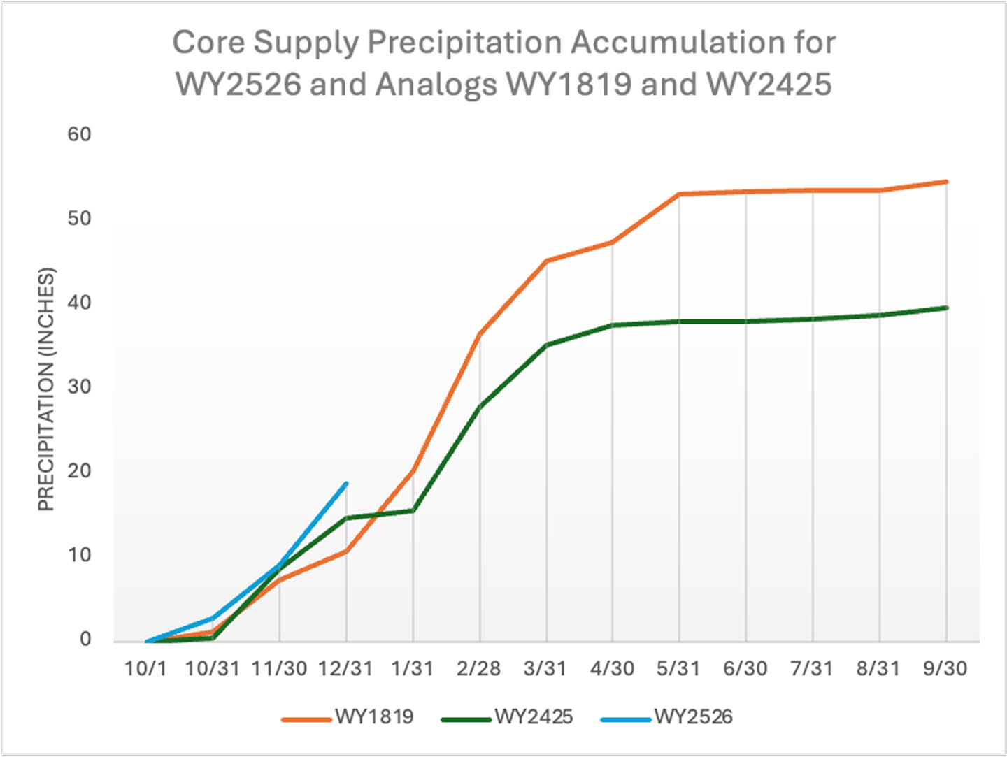
Analog Comparison
The image below features the Core Supply precipitation accumulation for analog water years 2018‑19 and 2024‑25 alongside the present year. Both analogs started the water year strong, but with the significant accumulation over the past couple of weeks, the accumulation for the Core Supply (blue line) has now exceeded both years but remains broadly consistent with the trajectory established by these analog water years.
Reservoir Supply Update
These late-December precipitation gains have immediate operational relevance, translating into increased runoff and improving early-season reservoir inflows across the Core Supply as we transition into January.
The following plots show the CRAFT inflow forecasts for Lake Shasta and Lake Oroville (blue bars) alongside observed inflows (green). The Department of Water Resource’s first B-120 forecast will be available in February (vertical dashed line). In the meantime, CRAFT fills the gap, providing critical early-season guidance for water managers.
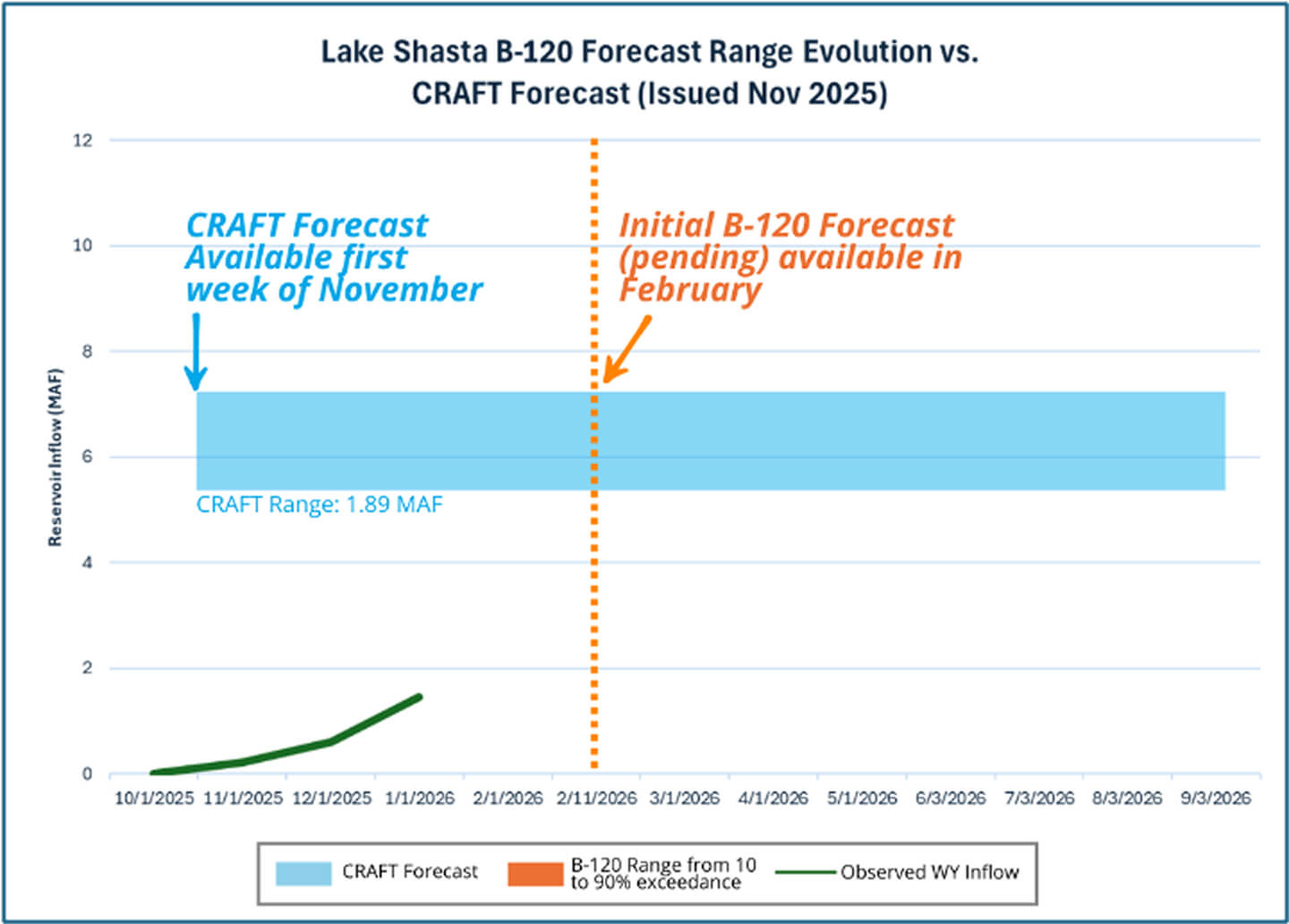
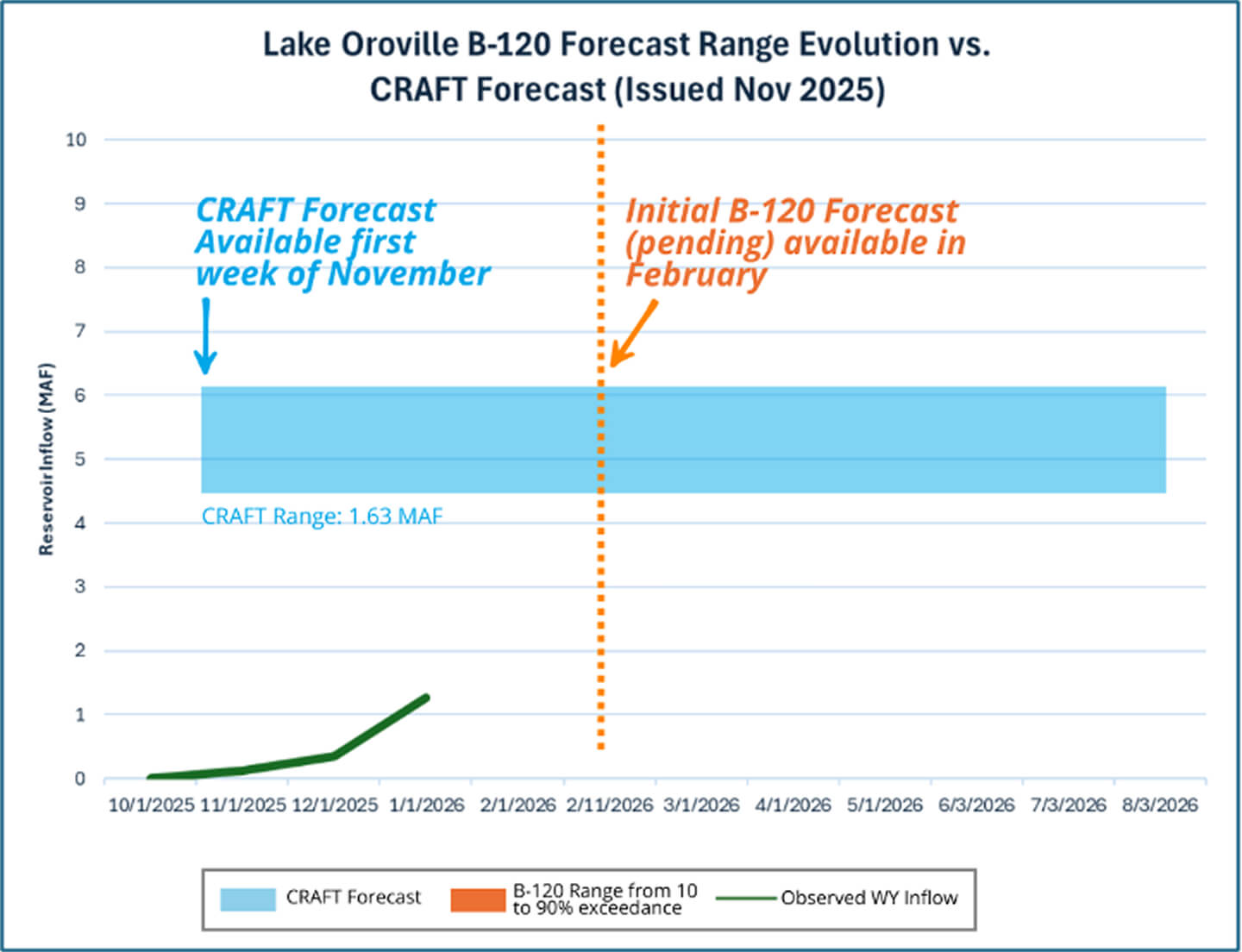
These plots highlight Shasta and Oroville, but for additional details on the reservoirs included in your subscription, please visit the CRAFT section of the portal that is accessible through the left sidebar menu.
